Lately we've been getting hammered with snow, and while snow is great for outdoor winter recreation it can cause havoc on the roadways. If you or loved ones are driving in Colorado this winter, perhaps travelling to or from Crested Butte for the holidays, remember our super-cool Driving Conditions page. We give you up-to-date information on road conditions around the state, harvested directly from CDOT. The data is conveniently organized into "trips" from CB to elsewhere in Colorado. Some trips have multiple routes so you can compare conditions and take the best route.
Some tips:
- Travellers driving up from Texas and the East will most likely want to view either CB to Raton Pass or CB to Denver trips.
- Travellers flying in to Colorado Springs and renting a car should obviously use CB to CO Springs.
- Travellers flying to Montrose instead of Gunnison should use the CB to Grand Junction trip. Ignore the Grand Junction info, you won't be driving that direction.
- Some routes show conditions for Cottonwood Pass. If Cottonwood is closed (as it is now) you drive via Hwy 50 over Monarch Pass. Monarch Pass conditions are always shown on the same report as Cottonwood. Don't think that if Cottonwood is closed the route is impassable!
- If your route takes you over Monarch Pass, check out the live webcam image. Many other useful webcams are available on the left side of the Colorado Webcams page.
If you are flying to one of Colorado's prominent airports, you can check the airport weather on our Airport Conditions page. This information comes from the FAA's AWOS automated reporting sites. Note also there are two non-airport condition reports for Monarch Pass and Wolf Creek Pass.
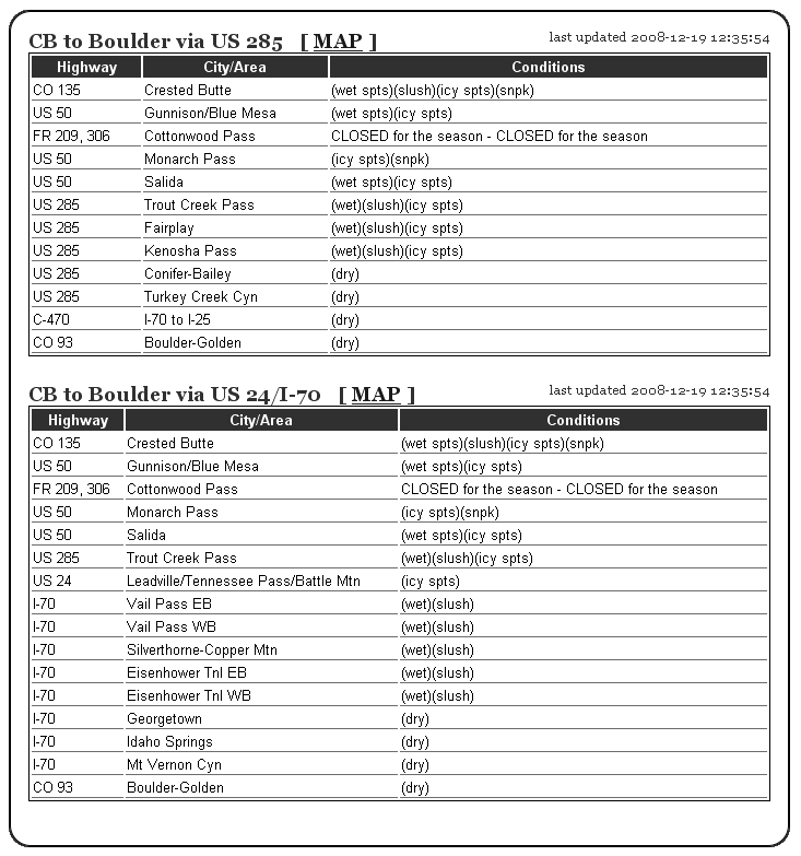
Here is a sample report for the trip from CB to Boulder as of 12:30 pm today. Looks about right, I'd probably add 15 minutes to my expected driving time given this report. Your mileage (so to speak) may vary.

Please drive safe!